Photo Gallery
Addressing Huthwaite
Common Road - B6027
The B6027 covers a steep 1.1 mile straight route, taking giant steps southward from Huthwaite through a deep valley to join the A38 in Fulwood. Common Road covers two distinct sections since modern roadways offered nearest M1 access at Junction 28. North end began suiting residential expansion through a past mining era down towards old pit rail crossing. South section attracted further industrialised sites as companies began realising this offered centralised access into major road networks supporting nationwide distribution.

(Commonside - New Road)
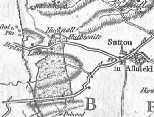
Chapman's 1774 Nottinghamshire map makes up for lacking minor pathway detailing by exposing broader extent of long classified common land. Covering such significant amounts of Hucknall grounds under Huthwaite heights firmly identifies true origins behind alternatively naming Dirty Hucknall. Updated explanation should likewise understand more ancient similarity lay behind a foul wood descriptively naming Fulwood. In essence, these areas simply recognised useless waste inside a protected Sherwood Forest.
Proving any grounds would be no loss to the crown actually granted parishioners the right to share free common use of meadows for raising livestock. A pathway accessing larger commons was usually called Commonside, until changes here refer to Hucknall Road. The 1794 Act to divide and enclose the Commons and Waste lands of Sutton-in-Ashfield results in carving a direct 40 feet road towards Fulwood. Width asserts future status by branching off a major highway connecting Alfreton to Mansfield. Worth noting here that surveyors didn't refer to a next mapped Hucknall Common when their planned enclosures all spanned Fulwood Common.


16 Oct 04 by Gary Elliott Updated 28 Dec 19
